


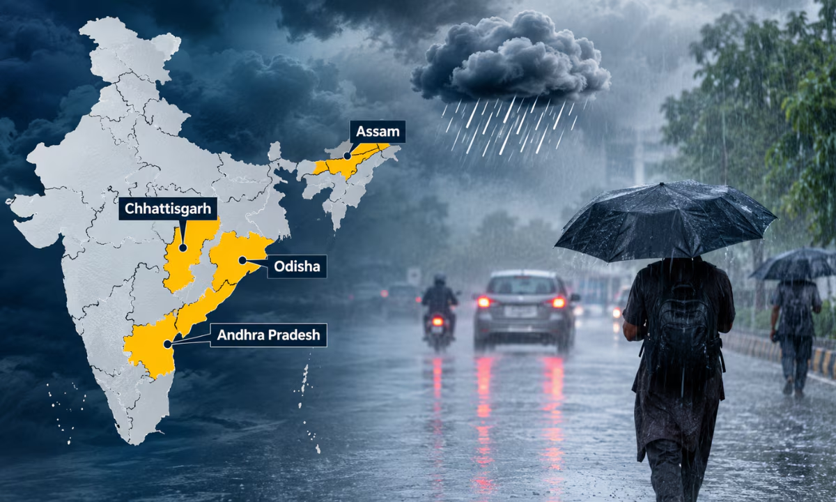
IMD has issued a heavy rainfall alert for Assam, Andhra Pradesh, Chhattisgarh and Odisha in its weather forecast for October 28Check state-wise weather updates and rain warnings.
Published: October 27, 2026, 5:09 PM IST
Share Article
https://www.india.com/news/india/tomorrow-weather-october-28-forecast-imd-issues-heavy-rain-alert-for-assam-andhra-pradesh-chhattisgarh-and-odisha-8539744/
IMD weather forecast
Tomorrow weather October 28 forecast: Amid the impact of Severe Cyclonic Storm Arnab, the India Meteorological Department has issued a severe weather alert for October 28The top weather department has predicted that several states will witness heavy rainfall, thundersqualls and strong winds under the influence of Severe Cyclonic Storm ArnabSevere weather warnings cover central, eastern and southern India, alongside gale winds over the Bay of Bengal reaching up to 140 km per hour during landfallRegions remain on high alert due to potential flash flooding and surface runoffHere are all the details you need to know about the weather prediction issued by the IMD for October 28.
IMD Area Wise Weather Predictions for October 28
Rainfall Warnings
-
Extremely Heavy Rainfall at Isolated Places: Coastal Andhra Pradesh, Chhattisgarh and Odisha.
-
Heavy to Very Heavy Rainfall at Isolated Places: Vidarbha and Telangana.
-
Heavy Rainfall at Isolated Places: Assam and Meghalaya, Nagaland, Manipur, Mizoram and Tripura, Andaman and Nicobar Islands, Gangetic West Bengal, Jharkhand and East Madhya Pradesh.
Thundersquall and Wind Alerts
-
60 to 70 km per hour gusting to 80 km per hour: Isolated places over Chhattisgarh and Odisha.
-
50 to 60 km per hour: Isolated places over Jharkhand and Telangana.
-
Strong Surface Winds: Isolated places over Interior Karnataka and Andhra Pradesh.
-
Gale Wind 115 to 125 km per hour gusting to 140 km per hour: Over westcentral and adjoining Eastcentral Bay of Bengal.
Thunderstorm, Lightning and Gusty Winds
-
40 to 50 km per hour Gusts: Bihar, Haryana, Chandigarh and Delhi, East Madhya Pradesh, Maharashtra, Andaman and Nicobar Islands and Gangetic West Bengal.
-
30 to 40 km per hour Gusts: East Uttar Pradesh, Interior Karnataka, Rayalaseema and Kerala and Mahe.
-
Lightning Only: Isolated places over Assam and Meghalaya.
Moderate Flash Flood Risk and Inundation Watersheds
-
Coastal Andhra Pradesh and Yanam: Bapatla, Guntur, Krishna, NTR District, Eluru, West Godavari, Dr B R Ambedkar Konaseema, East Godavari, Kakinada, Sri Alluri Sitharamaraju District, Anakapalli, Vishakhapatnam, Vizianagaram, Srikakulam and Parvathipuram Manyam districts.
-
Odisha: Malkangiri, Koraput, Nawarangpur, Rayagada, Gajapati, Ganjam, Kalahandi and Kandhamal districts.
-
Chhattisgarh: Dantewada, Bastar, Narayanpur and Kondagaon districts.
Weather Update FAQs (October 28)
Q.1 What is causing the severe weather on October 28?
Severe Cyclonic Storm Arnab forming over the Bay of Bengal is bringing heavy rainfall, thundersqualls, and strong winds to central, eastern and southern India.
Q.2Which areas are under an extremely heavy rainfall alert?
Isolated places over Coastal Andhra Pradesh, Chhattisgarh and Odisha are expecting extremely heavy rainfall.
Q.3What are the expected wind speeds?
Gale winds over the Bay of Bengal will reach 115 to 125 km per hour, gusting up to 140 km per hour during landfallThundersqualls of 50 to 80 km per hour are expected over Chhattisgarh, Odisha, Telangana, and Jharkhand.
Q.4Where is the flash flood risk highest?
Moderate flash flood risks and surface inundation are expected in low-lying areas across Coastal Andhra Pradesh, Yanam, Odisha and Chhattisgarh.